Speed Layers
Speed Signs
The Speed Signs Layers Can be accessed via the Speed Folder in the Layer Tree.
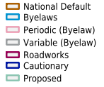
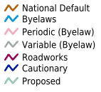
The Layer can be viewed using the 6 diferent thematics.
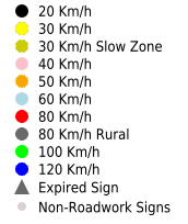
Speed Signs - Standard
Standard Speed Limits signs display the standard maximum speed at which vehicles are legally permitted to travel on specified public roads.
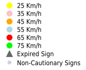
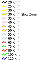
Speed Signs - Cautionary
Cautionary Speed Limit signs may be used to advise motorists of the maximum speed at which they are advised to travel at, due to the temporary nature of the road surface during and following roadworks.
These limits are not enforceable under the Road traffic Act and are generally in the range of the odd numbers; 25, 35, 45, 55, 65 or 75 km/hr.
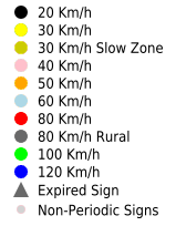
Speed Signs - Periodic (Byelaws)
The Periodic Bye-Laws establish the maximum speed at which vehicles are legally permitted to travel on specified public roads at a particular time of day.
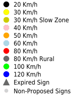
Speed Signs - Proposed
Proposed Speed Limits establish the proposal of a maximum speed at which vehicles are legally permitted to travel on specified public roads.
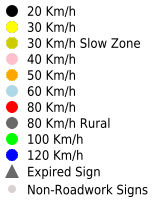
Speed Signs - Roadworks
Speed Limits assigned to roads where road maintenance is occurring. Roadworks Speed Limits require both a start and end date to be entered.
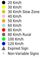
Speed Signs - Variable (Byelaws)
The Variable Bye-Laws establish the maximum speed at which vehicles are legally permitted to travel on specified public roads at a particular time of day.
Speed Ramps
Speed Ramps are added using the Surface Type App (MapRoad PMS - Mobile Application).
The Surface Type App is an Android based application that forms part of the MapRoad Mobile Suite of Apps. Similar to the Pavement Surface Condition Index (PSCI) App, the Surface Type App is used to visually capture the surface material type in use on local and regional roads in each Local Authority.
The results of the Surface Type survey are captured using a Samsung Galaxy 10.1 Tablet. Once a survey has been completed the results can be instantly uploaded (using 3G or WiFi) to a Server hosted by the Local Government Management Agency (LGMA). Once successfully uploaded the results of the Surface Type survey are immediately visible (as a map layer) within the Pavement Management System (PMS).

Speed Limit Surveys
The Speed Limit Surveys Layer is accessible in the Speed Limits Editing folder in the Layer Tree.
The Layer can be viewed in 2 distinct Thematics.
Speed Limit
The Speed Limit thematic displays the speed limits for the diferent Road Segments surveyed.
Limit Type
The Limit Type thematic displays the speed limits for the diferent Road Segments surveyed, in relation to the type of limit for the Road Segments.
Speed Limit Zones
The Speed Limit Zones Layer is accessible in the Speed Limits Editing folder in the Layer Tree.
The Layer can be viewed in 2 distinct Thematics.
Speed Limit
The Speed Limit thematic displays the speed limits defined by zones, represented by polygons.
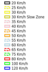
Limit Type
The Limit Type thematic displays the speed limits for the diferent zones surveyed, in relation to the type of limit for the Zones defined by Polygons.