PMS 5.4 Release Notes
Released 15/12/2021
This release contains a number of new features, enhancements to existing features, and the migration of all modules to the new user interface. The “classic” user interface has now been retired and is no longer available. The PMS URLs e.g. https://tipperary.maproadpms.ie now opens the main mapping system once a user is logged in. The dashboard is now integrated within the main mapping system and can be opened by clicking the dashboard button in the “Map Tools” toolbar (highlighted in the image below):

The 5.4 release also sees PMS move to new servers and infrastructure. This should improve performance of the system and handle increasing use of the system.
SQL Server 2016 database moved to SQL Server 2019 and to a new database cluster
The 3 Windows 2008 Servers where PMS has been hosted for the past ~10 years have been replaced with 2 new Windows 2019 Servers
Features and Enhancements
Information Tool
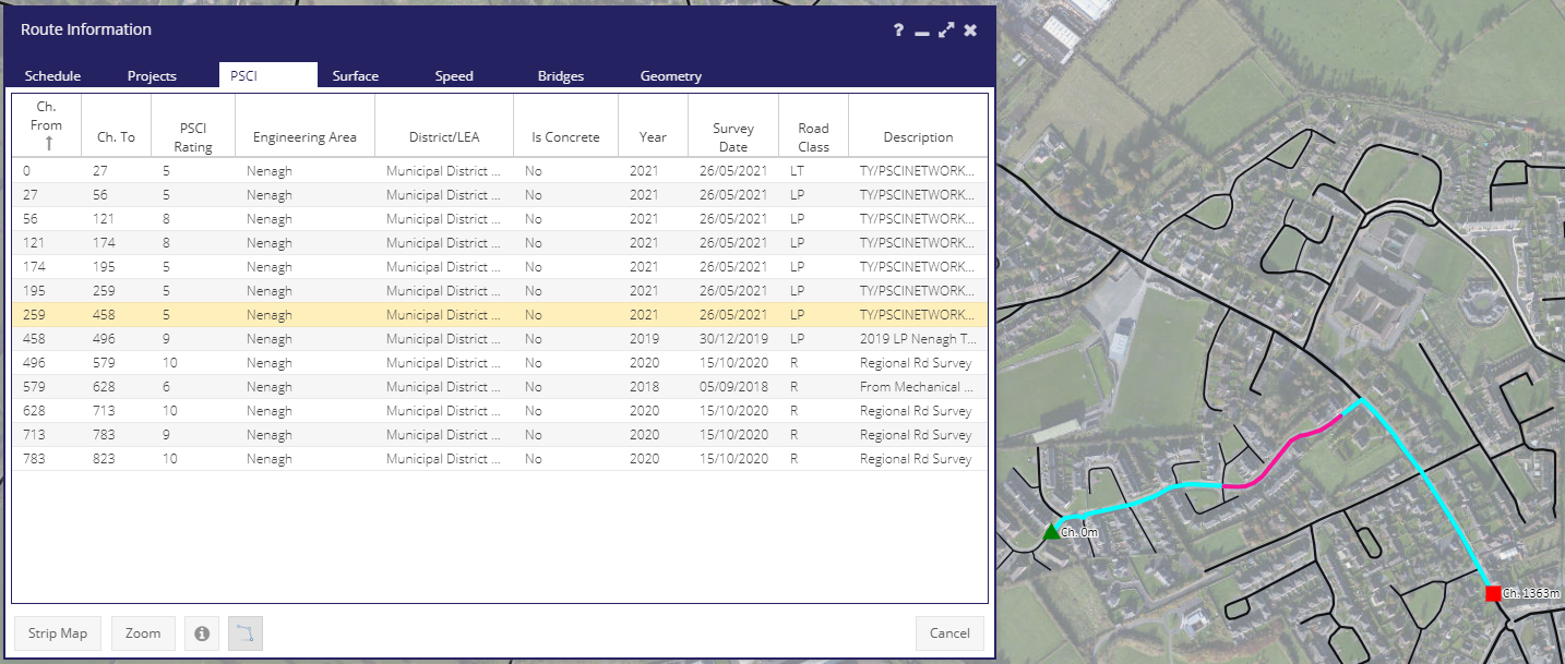
PMS 5.4 includes a new powerful Information Tool. This has all the functionality of the Information Tool in the “classic UI”, but also shows the chainage of all features along the selected route.
Layer Updates
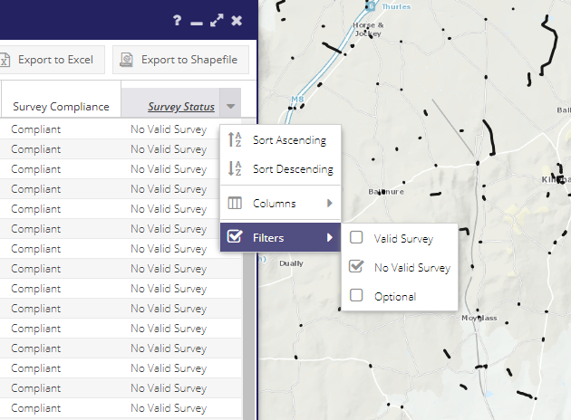
The following 3 layers have all been updated to include not only sections of the road schedule where surveys have taken place, but also sections without any survey.
This allows non-surveyed sections to be filtered, displayed and exported, and can be used to decide which parts of the road schedule should be part of future surveys.
Road Programme Project Extents
Prior to the 5.4 release projects were displayed in the Roads Programmes forms (for both Roads Programmes and LA Roads Programmes), but selecting a record in the grid didn’t highlight the project geometry as in other grids. This was due to the amount of data involved in loading sometimes 300+ project geometries into the Roads Programmes form.
In the 5.4 release when a Programme form is opened the associated projects are shown on the map. The projects are symbolised based on their Phase:

Selecting a project record(s) in the grid now highlights the relevant project(s) in the map with an outline box in cyan:
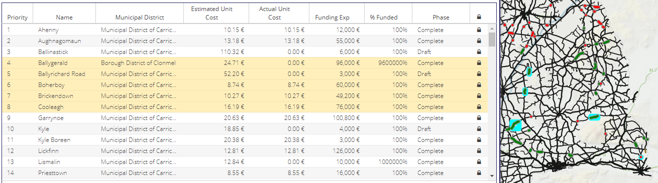
In addition a new “Zoom” button has also been added which zooms to the extent of all projects in the programme.

Grids
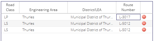
The grids used to create various surveys have been updated with new filters to allow for more powerful filtering and selection options. The following fields have been added:
Engineering Area
District/LEA
Road Class
Road Name
Road Category
Average Width (m)
Route Number
Grids on the following forms have been updated:
The new fields can be used to filter roads in a survey. For example an initial selection is made with the polygon tool:
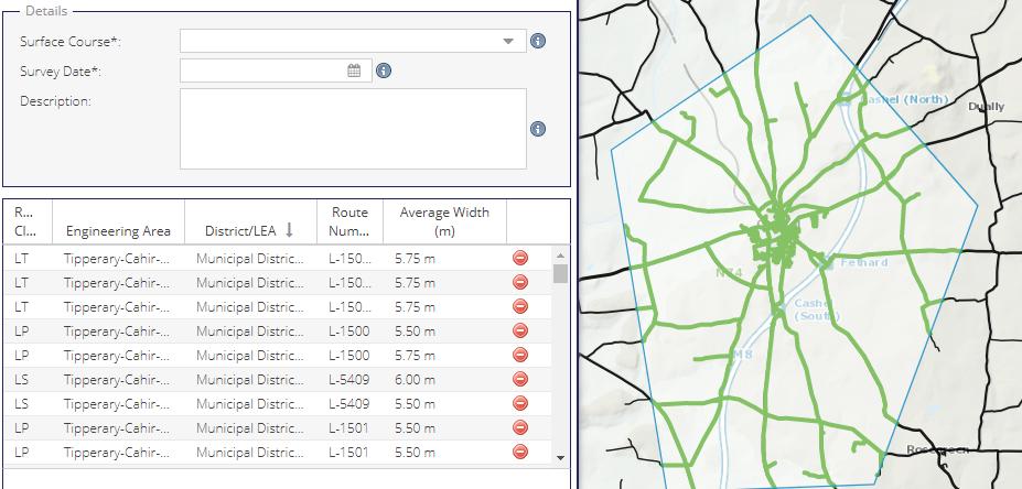
Then only roads with an average width > 7m can be selected. When the survey is saved only roads with a width greater than 7m will be included:
Form A
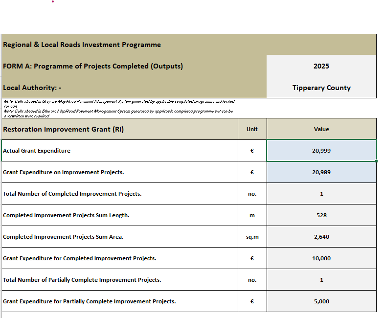
The 5.4 release allows Form A to be exported from with PMS. This function is available on the dashboard within PMS:
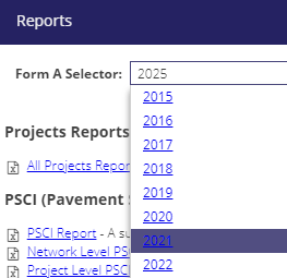
Clicking on the year will generate and download the Form A in an Excel spreadsheet:
Migrated Modules
The following modules have been ported from the “classic” UI to the new user interface. All functionality for these modules available in the old system is available in the new system.
Road Schedule Module
Bridges Module
BridgesEngineeringInspectionFiles
BridgesEngineeringInspectionGeneral
BridgesMaintenanceInspectionFiles
BridgesMaintenanceInspectionGeneral
Speed Signs Module
Miscellaneous Changes
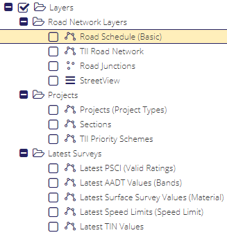
Layer Tree Updates
Layers in the layer tree have been regrouped to make it easier to find layers.
Valid PSCI Survey Threshold Changed from 100% to 90%
To move from “Draft” to “Planned” and from “Awaiting Post-Works Survey” to “Surveyed Post-Works” previously required 100% of the project location to be surveyed. Due to difficulties with GPS and data capture this threshold has been dropped to 90%. See Project Phases for more details. Any existing projects which have > 90% and < 100% valid PSCI surveys have been moved to the next phase automatically as part of the 5.4 release.
LA Roads Programme Form
An additional “Last Submitted Exp” field has been added to the LA Roads Programme General Tab, in the “Funding” fieldset. This value can be used to confirm that values in Form A are correct, and also so an admin can check if the Funding Expenditure Total and the Last Submitted Cost differ. If this is the case then the user knows they need to resubmit the LA Programme.

Python Library Updates
bottle==0.12.19 (from 0.12.16)
click==7.1.2 (from 7.0)
requests==2.26.0 (from 2.2.1)
shapely==1.7.1 (from 1.6.4)
waitress==1.4.4 (from 1.1.0)
mappyfile==0.9.2 (from 0.7.6)
Pillow==6.2.2 (from 5.4.1)
Support Tickets Resolved in this Release
https://support.maproadpms.ie/Ticket/1820 - Multipart Project Geometries
https://support.maproadpms.ie/Ticket/1808 - Post-Works Surveys Coverage
https://support.maproadpms.ie/Ticket/1807 - Select by shape tool not working for complicated polygons
https://support.maproadpms.ie/Ticket/1792 - Post work survey percentage
https://support.maproadpms.ie/Ticket/1790 - Material cost disappears once you save draft?
https://support.maproadpms.ie/Ticket/1770 - Projects Filter by Programme
https://support.maproadpms.ie/Ticket/1814 - Zero Length Roads Issue
Data cleanup from RMO:
https://support.maproadpms.ie/Ticket/1794 - Updated Engineering areas to be added
https://support.maproadpms.ie/Ticket/1813 - Invalid Segment Fixes