Schedule - Grid
For general functionality available in the grid window see the General Grid documentation.
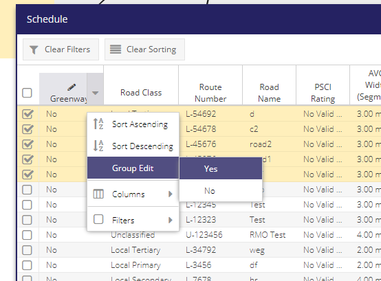
This is an editable grid, see the Is Greenway? section below for info.
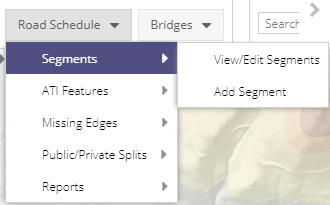
To view and edit/delete a previously created Segment a user can click on View/Edit Segment under the Segments dropdrown menu. This will open the Schedule window containing a list of all the Segments for your Local Authority. Double clicking on an entry will open the Segment’s Edit Form with the information relating to that Segment.
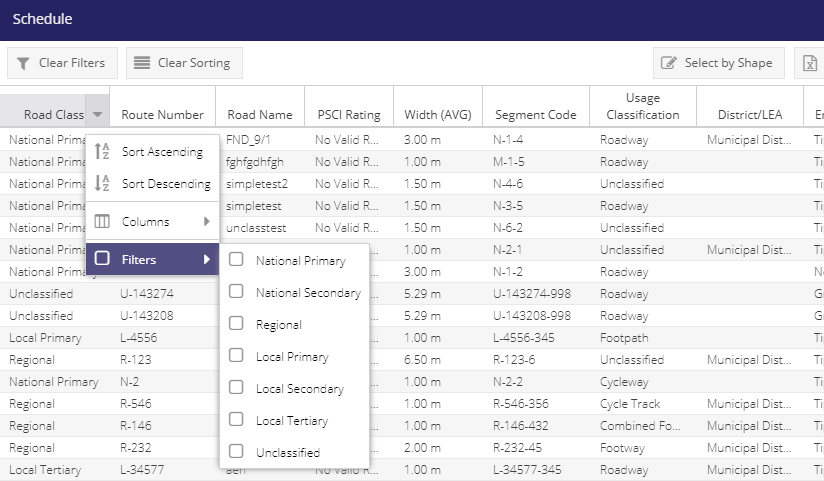
The Schedule grid has 30 columns which can be used to filter the map layer and extract data relevant to a user’s current task. Some of these are hidden by default.
Column |
Filter Type |
|---|---|
Road Class |
List of values |
Route Number |
Text |
Road Name |
Text |
PSCI Rating |
List of values |
Width (AVG) |
Numeric |
Segment Code |
Text |
Usage Classification |
List of values |
District/LEA |
List of values |
Engineers Area |
List of values |
Licensing Area |
List of values |
Computed Length |
Numeric |
Is Greenway?
Segments can be marked with an Is Greenway = True value if that segment forms part of a Greenway.
To do this:
Add the Greenway editibale column to the grid.
toggle the Group Edit button On.
Check the checkboxs for Segments that are part of a Greenway
Access the context menu from the Is Greenway column
Hover over Group Edit
Select ‘Yes’
Greenway Segments can be viewed in the Greenway? thematic of the Schedule map layer.