Projects
A Project is a collection of road segments where a specific road maintenance procedure is carried out by the Council under a specific road maintenance grant.
Note
As of PMS 6.1, users can create a project of any category besides Pavement without creating a project (linear) or auxiliary (point and/or polygon) geometry. Pavement projects must have a linear feature i.e. they cannot be saved with an auxiliary feature only.
Viewing Projects
Project and associated data can be viewed over three map layers. These layers are found in the Projects folder of the layer tree.
Projects. Project line geometries are displayed here with 6 different thematics.
Project Auxiliary Items. Project auxiliary feature geometries are displayed here with 4 different thematics.
Project Start End Points. Point geometries denoting where a projects start and end.
Project Sections. Line geometries for each Section of a project.
Project Groups
Nominal Links can created between projects by creating Project Groups.
Project Phases
Depending on a Project’s Type (see below), a project is subject to a specific phase logic described here.
Project Categories and Types
PMS users can create Projects from any one of the following categories and types:
Category |
Type |
|---|---|
Pavement |
Regional and Local Road |
Pavement |
National Road |
Pavement |
Non-public |
ATI |
Footway |
ATI |
Footpath |
ATI |
Cycle Track |
ATI |
Cycleway |
Drainage |
Drainage |
Structure |
Bridge/Culvert |
Safety |
Safety |
Adding Projects
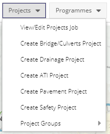
To add a new Project of any category, select the Projects dropdown from the Data Editing toolbar. From this list, select the category of Project you wish to create.
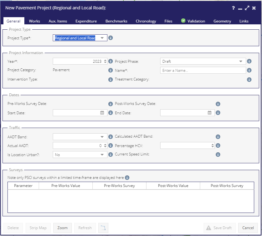
Once you have selected a Project category, a new form will open. The tabs and sections available in this form will depend on the type of Project chosen.