Public Private Splits
The Road Schedule toolbar includes the Public-Private splitting tool. This allows users to divide a road edge into two parts, marking one part as part of the public road schedule and the other a private road that is not the responsibility of a local authority. To create these splits a user needs to be a part of the Road Schedule Editor group, and be logged in. Any user can view the list of Public Private Splits in the system.
Public/Private Splits Layer
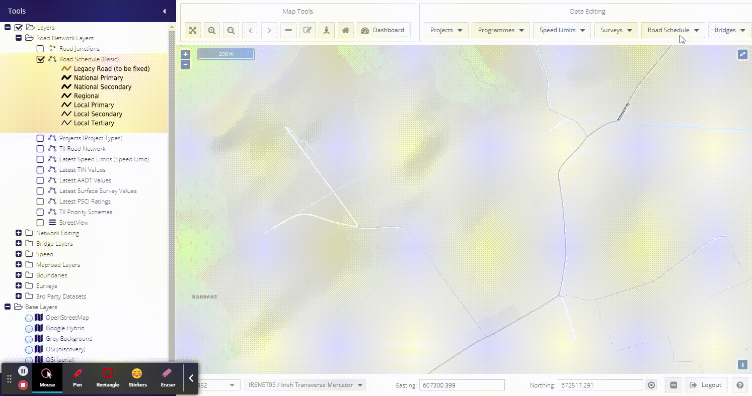
The Public/Private Splits WMS layer can be found under the Network Editing folder in the layer tree. The layer is styled as being one of:

Right clicking the layer will produce a context menu where users can:
Open associated layer grid
Set the opacity
Turn on labels (including line direction for public roads)
Access layer Metadata
Public Private Splits Grid
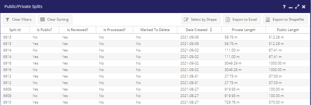
The Public Private Splits grid is similar to the other grids in the system - records can be sorted and filtered. By default a Processed? filter is applied to the list and only Public Private Splits created following an update to the road network are shown. Public Private Splits will be added in batches to the road network as part of regular updates, and once processed will be hidden from this list by default.
The filter can be cleared using the “Clear Filter” button, or the sub-menu at the side of the Processed? column, and all previously processed Public Private Splits will be displayed.
Public Private Splits with Processed? set to “Yes” have already been applied to the road network. The Date Processed column indicates the date the split was applied.
The Private and Public lengths of the split are displayed in the list. There is also a Reviewed? column. This contains a Yes or No value to indicate if the split has been manually reviewed, or created by someone in the local authority.
- This grid can also be filtered by:
Is Public
Marked To Delete
In 2017/2018 a number of public private splits were applied to the road schedule based on the following criteria:
The road is unattached at one end
The road class is Local Tertiary (should be run for all Local roads?)
The transferred (Prime2) length is over 100m longer than the MapRoad length
The MapRoad segment length was greater than 0
This work is fully documented on the Public Private Splits summary page. By default all these splits have their Reviewed? value set to No, until a user has manually opened the split record and clicked the Reviewed? box on the form below.
Public Private Splits Form
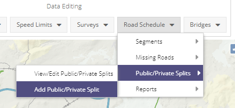
To add a new Public Private Split select “Add Public-Private Split” from the “Road Schedule” menu. The scissors tool can then be activated from the form. This allows a user to click on a network edge (any edge in the Network Edges layer - both registered and unregistered roads), and split it into two parts.
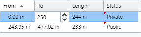
When a point along the edge is selected the road is displayed in two parts, an orange part representing a private road, and a green part representing a public road. The grid on the form is populated with two records representing each of these parts.
If the road is unattached at one end, then by default this part of the road is designated as private. If the road is joined to the road schedule at both ends, or a user wishes to switch which part of the road is public the status value can be set directly in the grid:
If a user knows the distance along the road of where it becomes private this value can be entered in the To column in the grid. The geometry in the map will automatically update to reflect these values.
For new Public Private Splits the Date Processed field will be read-only. The date will be set during a back-end offline update process where all splits are reviewed, and if valid applied to the network.
The Reason for Split text box should provide as much detail as possible as to why the road should be split, and is mandatory.
For any of the Public Private splits that were added as part of an automated process the form will display an additional checkbox Reviewed by LA?. If a user checks the split is correctly located then this box can be checked, and the split will be assumed to be correct. When the split is opened subsequently this checkbox will no longer be visible.
Deleting and Editing Public Private Splits
It is not possible with the Public Private Split tool to split an already split road. This would add another level of complexity to the system and managing the road network. It is however possible to edit and delete splits.
For any non-processed splits you can simply open the existing record and use the scissors tool to select a new point along the line. You will also be prompted to open an existing record if you click on a road that is already awaiting processing.
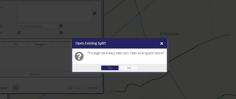
If a split has already been processed then the scissors tool will be disabled - once a split has been processed it cannot be edited. If a user clicks on a road with an already processed split then they will be prompted to open the original record.
If the split is in the wrong location then the split record should be deleted, and then it will be possible to create a new split along the original non-split geometry.
A user can update the Reason for Split and Reviewed by LA? fields at any time.
Workflow
It is important to note that splits are not created on the road network as soon as the split is created. The tool is used to mark-up where these splits should occur, and these are then reviewed as part of an offline process before the road network geometry is actually split. Once the split has been made then the individual parts can be added or removed from a road segment as appropriate.
Any data associated with the split road will be maintained, and applied to the two new parts based on chainage and distances.