General Grid Functionality
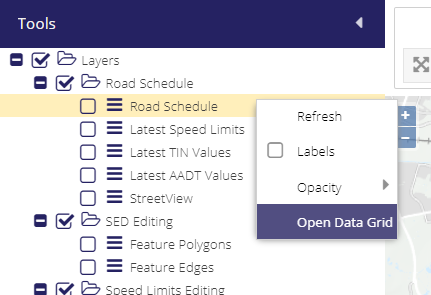
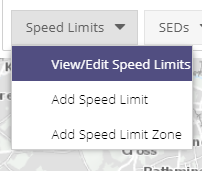
The layer grids provides a powerful interface for analysing the data available in the PMS System. They can be opened by accessing the context menu of any layer in the Layer Tree by right clicking on layer and selecting Open Data Grid, or by clicking the View/Edit section on any of the drop downs that are in the Data Editing toolbar.
Right Click
Drop Down List
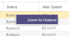
Zooming to Features
Right-clicking on a record will allow you to zoom the map to the feature.
Opening forms
Double-clicking the record in the grid will open the data editing form for this feature.
Columns
Grids contain a number of columns, some more than others. When a grid has so many columns as to make the data unreadable, some are hidden by default. Columns can be added to and/or removed from the grid by clicking on any of the column drop down arrows and checking which columns should be made visible:
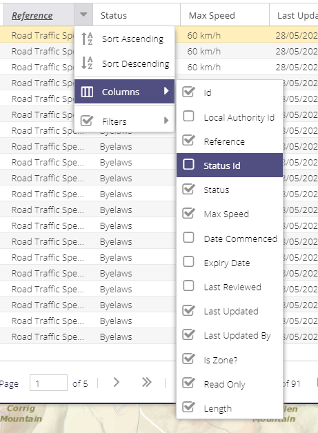
columns can be reordered by dragging the column header to a different location
data can be sorted by any of the columns by clicking on a column header
all columns should be filterable.
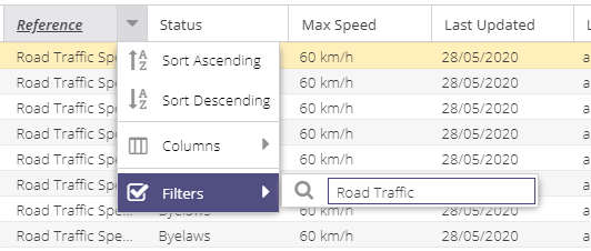
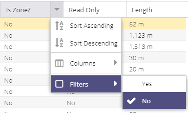
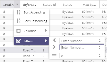
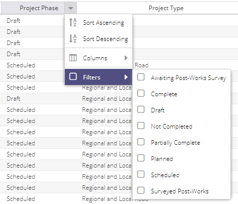
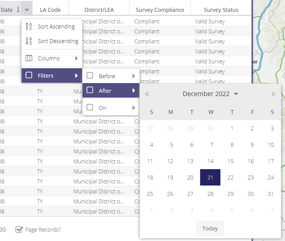
Filtering
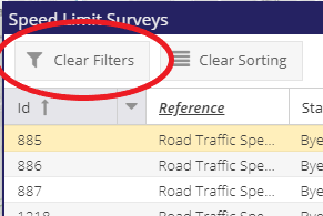
Filtering has been configured for nearly all columns in the grid. Filters can be activated by clicking on the dropdown arrow of a column header. The Clear Filters button can be used to remove all filters from the grid.
Text Filters
Type in letters or words to perform a free text search on the field.
Boolean Filters
These allow filtering based on True/False or Yes/No values.
Numeric Filters
These allow filtering based on a range, or an exact number.
List Filters
Filter by checking from a list of available values.
Date Filters
Date columns can be filtered via a calander select. Users can ask for all records before a certain date, after a date, or on a specific date.
Layer Filtering
A powerful feature of the grid is that is also applies its filters to the map layers. All of the layers are filtered to match the records in the grid.
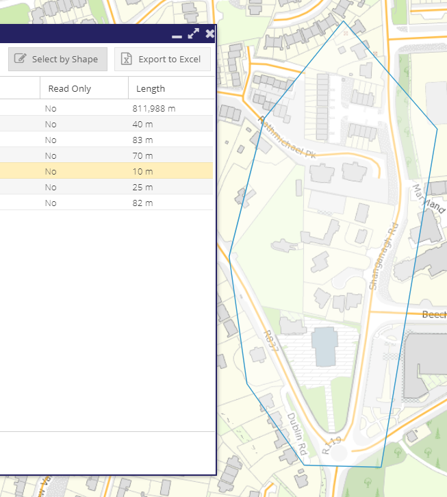
Spatial Filtering
The grid has a spatial query tool that can be used along with the attribute filters. Select the tool and draw a polygon on the map to spatially select features.
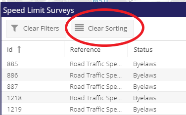
Clear Sorting
The grid has a clear sorting tool that can be used to remove any sorting that has been applied with one click. All of the results will then return to how they were displayed prior to sorting
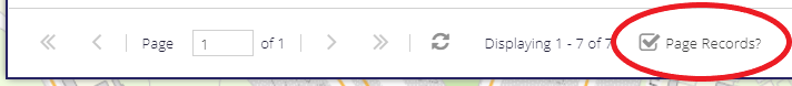
Page Records
Turn off “Page Records?” to show all records in the grid. Note this will make browsing records slower
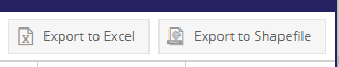
Export
Records from any of the Data Grids can be exported to excel by using the “Export to Excel” button or to shapefile by selecting the “Export to Shapefile” button.
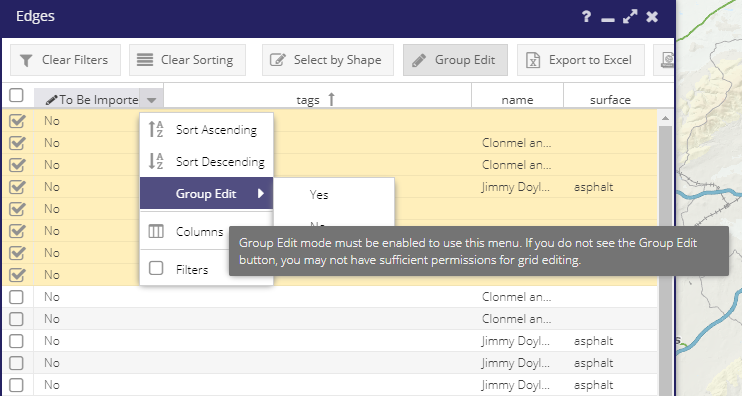
Group Editing
Group editing allows users to select from a range of values for some grid columns and to save these new values back to the PMS database.
To use:
- Click the Group Edit button:
now any column with a pencil icon will become available for new data selection.
a check box will appear in the far left of then grid
Check the checkbox for each record that is to have the new value applied
Click the down arrow to the right of the column header. This will open a new context menu.
Hover over the Group Edit option. This is give the user the possible values to choose from.
Select the appropriate value
Select YES in the resulting pop up.