Public and Private Roads
The Prime2 roads dataset focuses on the location of the roads, but not their ownership. This is a critical piece of information for local authorities, as they need to know which roads they are responsible for. As Prime2 has geometries from junction to junction, it is easy to remove entire sections from the road schedule, but currently not possible to remove part of a road.
One possible solution is to split the Prime2 geometries. However this approach would require a new toolset to be developed, and would also mean a divergence between the Prime2 dataset and the roads within PMS. Ideally this situation would be avoided as it will become harder and harder to update the PMS roads to the latest Prime2 data, and the time and effort to maintain the roads schedules would fall back to the LAs. It would also mean sharing data between different agencies becomes harder over time as unique IDs would be different in PMS than Prime2.
OSi may be open to splitting and managing these changes directly, and assigning each section a different class. It is however up to the LAs to report these to the OSi to facilitate this process.
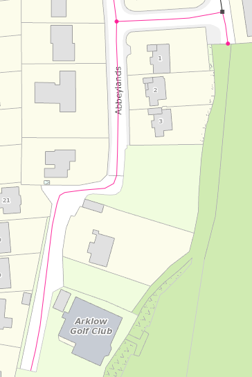
An example of change of ownership along a road is given below. There is a line across the road polygon in Prime2, however the centreline (in purple) is a single edge. The southern section of the road (near the golf club) is private, and not part of the LA’s road schedule.
Reporting these Roads
A database query has been written to try and automatically find these roads, so they can be reported to the OSi. The query selects any roads that have the following criteria:
The road is unattached at one end
The road class is Local Tertiary (should be run for all Local roads?)
The transferred (Prime2) length is over 100m longer than the MapRoad length
The MapRoad segment length was greater than 0
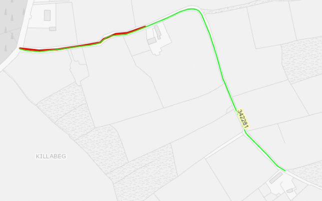
An example of one of the roads returned from this query is below:
An Excel report of these records can also be created for each LA. This report contains the following fields:
SegmentCode - the segment code (e.g.
L-43641-0)Class - road class, currently only
LT- local tertiaryOldLength - the length of the segment in MapRoad
NewLength - the length of the segment following transfer
OldSegCount - the number of edges making up the segment in MapRoad
NewSegCount - the number of edges making up the segment in OSi
URL - a URL to open the PMS at the location of the segment
First OsiGuid - the GUID used by the OSi for the first edge of the segment (this can be used by the OSi to locate the edges to split)
False Positives
The criteria above will also list false-positives - unattached roads that are now longer in Prime2, but for reasons other than ownership. For example, in MapRoad the road below has an additional side road that is not present in Prime2:
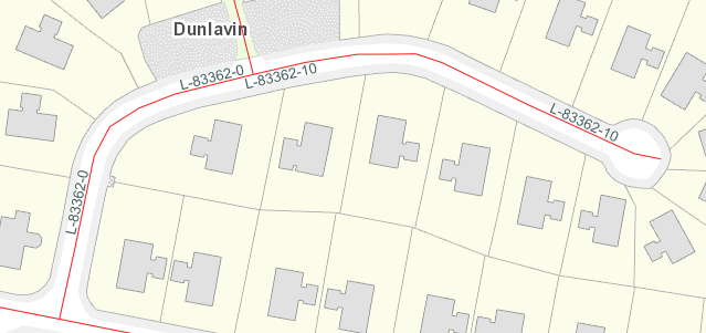
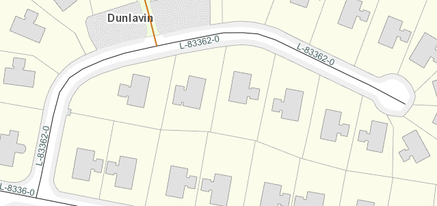
After the migration to Prime2, the L-83362-0 is now the entire length if the cul-de-sac, and so meets the criteria of the report above.
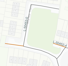
A similar example is shown below. In MapRoad there are two separate segments - L-50453-4 and L-50453-0.
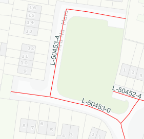
In Prime2 only L-50453-0 remains.
Record Counts
Below is a summary table listing the number of records in each LA that may require splitting due to ownership. Any LAs with a 0 count have not yet been transferred to Prime2.
Local Authority |
Possible Split Ownership Count |
|---|---|
carlow |
15 |
cavan |
54 |
clare |
79 |
corkcity |
12 |
corkcounty |
245 |
donegal |
120 |
dublincity |
67 |
dunlaoghaire |
43 |
fingal |
53 |
galwaycity |
14 |
galwaycounty |
0 |
kerry |
146 |
kildare |
53 |
kilkenny |
51 |
laois |
34 |
leitrim |
42 |
limerick |
89 |
longford |
77 |
louth |
29 |
mayo |
218 |
meath |
118 |
monaghan |
10 |
offaly |
29 |
roscommon |
276 |
sligo |
265 |
southdublin |
2 |
tipperary |
231 |
waterford |
38 |
westmeath |
99 |
wexford |
23 |
wicklow |
52 |