PMS 4.6.1 Release Notes
Released 22/07/2020
This is a patch release to resolve various UAT (user acceptance testing) issues arising following trial of the MRL (MapRoad Licensing) editing tools.
Enhancements
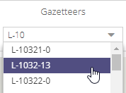
Road Segment Code Gazetteer added.
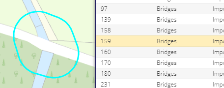
Selecting line and polygon features in grids now highlighted the corresponding feature in the map
Layers associated with the editing forms (AADT, TINs, SEDs) are no longer shown and hidden with the layer - they always remain displayed until the form is closed
Layers associated with the editing forms (AADT, TINs, SEDs) are now correctly destroyed when the form is closed, improving system performance
Minimised Windows shown with dark border to help with visibility

Circle tool options also highlighted with a dark border

Updated symbology for TIN layers

Updated symbology for AADT layers

Editing layers now grouped together in the layer tree
Performance greatly improved when saving Road Segments
Spatial Filter feature hidden in sync with grid
Circle Tool “Apply” button disabled if no radius has been set
Bug Fixes
Issue with layer grid loading incorrectly resolved - Apply tree structure after all layers are loaded
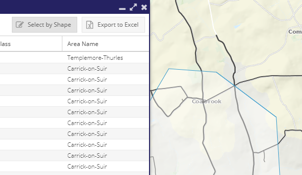
Select by Polygon fixed for the Road Schedule layer
Fixed spatial selection for SED layer
Polygons now correctly retrieved for AADTs, TINS, SEDs (fix IsZone flag setting)
Circles now correctly saved for SEDs (fixes “The save operation failed” error).
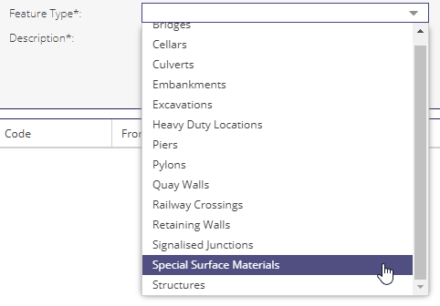
Added missing “Special Surface Materials” option to the SED Feature Type options
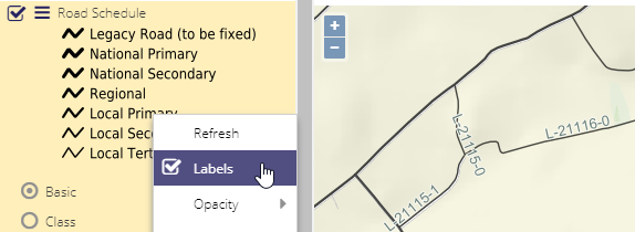
Fixed labels for Road Schedule layer
Circle toolbar now removed when the associated form is closed (or it remains and cannot be closed)
Update AADT band label from ‘10001 < AADT > 20000’ to ‘10001 < AADT < 20000’
SED Delete function fixed