General Tab
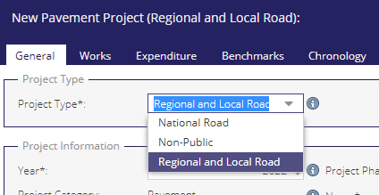
Users will select a Project Type for new Pavement or ATI Projects.
Project Information
Project Type: The type of project (This value cannot be edited after it is saved)
Year (mandatory [*] ): year of planned or completed Projects
Project Phase: Current Phase of the Project. New Projects will begin as ‘Draft’.
Project Category: Automatically generated.
Name (mandatory): A name for the Project.
Intervention Type: The majority calculated intervention type for the project based on the works section grid. Note for projects created prior to 2021 this would have been manually entered. [PP]
Treatment Category: The majority calculated treatment category for the project based on the works section grid. Note for projects created prior to 2021 this is based on a manually entered value. (pp)
Dates
Pre-Works Survey Date (pp):
This is the most recent date of any PSCI survey underneath the project geometry prior to the Construction Start Date. A valid survey is required to move from the Draft phase, and 100% of the geometry must be surveyed. The surveys must also be within 2 years of the Construction Start Date on Regional, Local Primaries, and Local Secondaries, and within 5 years on Local Tertiaries.
Post-Works Survey Date: Date of Post-Works Survey. (pp)
Start Date: Construction start date.
End Date: Construction end date.
Traffic
See the AADT page for detailed information on Annual Average Daily Traffic bands.
AADT Band: Annual Average Daily Traffic. This field is required to move out of the Draft phase. (pp)
Calculated AADT Band: Annual Average Daily Traffic. This is based on any AADT surveys already saved in PMS. (pp)
Actual AADT: The Actual AADT. (pp)
Percentage CV: Percentage of Commercial Vehicles. This field is required to move out of Draft phase. (pp)
Is Location Urban?: Is the projects created in an urban location? This field is required to move out of Draft phase.
Current Speed Limit: Existing Speed Limit. (pp)
Surveys (pp)
The Surveys Section of the General tab is available to National and Regional & Local Projects only. The drawing of a survey geometry is mandatory for saving a draft project.
Use the Line Tool to digitise a survey.
When working with the line tool, once a user has created a geometry and is adding sections for this geometry (under the Works tab), Automated Chainage Calculations come into play.
Save Draft
Once all mandatory fields are completed a user will be able to save a draft Project. Once saved, a warning icon will appear on the Validations tab. Once all validations are complete the phase can be updated.
Available under Pavement Projects only (National and Regional & Local)