Bridges Map Layers
The bridge map layers are found in the Bridge Layers folder of the layer tree. There are three layers:
Bridges
Prime2 Bridges
Bridge Intersections
Bridges
Jump to Grid
LAYER
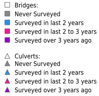
The bridges layer is a WFS layer where points cluster at smaller scales. This layer has 5 thematics:
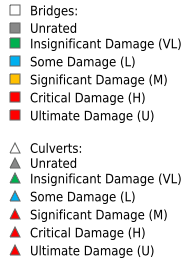
Maintenance Inspection
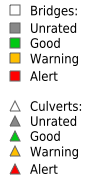
Engineering Inspection
Height Restriction
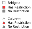
Weight Restriction
Years Since Maintenance
GRID
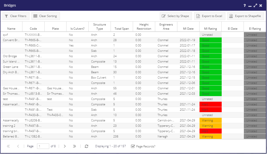
Main columns and filter types
Column |
Description |
Filter Type |
|---|---|---|
Name |
Name of structure |
Text |
Code |
LocalAuthorityCode + Road Number + B (if bridge)/C (if culvert) + next value |
Text |
Plate |
The structure name on Plate |
Text |
Is Culvert |
Is this point a culvert |
Boolean |
Structure Type |
Type of bridge/culvert |
List |
Total Span |
total of all spans |
Numeric |
Height Restriction |
Height restriction from signage |
Numeric |
Engineer’s Area |
The engineering area in which this point is located |
List |
MI Date |
Date of last maintenance inspection |
Date |
MI Rating |
Rating given at last maintenance inspection |
Numeric |
EI Date |
Date of last engineering inspection |
Date |
EI Rating |
Rating given at last engineering inspection |
Numeric |