Annual Average Daily Traffic Survey Polygons
This layer displays polygons created by users to define AADTs for a zone or area.
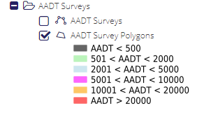
Right-clicking on the layer will open a grid displaying all Polygons entered in the system, Each AADT survey is displayed based on its count range. Double-clicking on these records will open the AADT survey in the AADT Survey form.
WMS/WFS layer name: AADTSurveys