PSCI Module
The PSCI module allows users to select stretches of the Road Schedule and apply a PSCI rating. This data is available to view across three map layers.
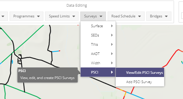
The PSCI Module is accessible via the surveys drop-down menu of the Data Editing toolbar.
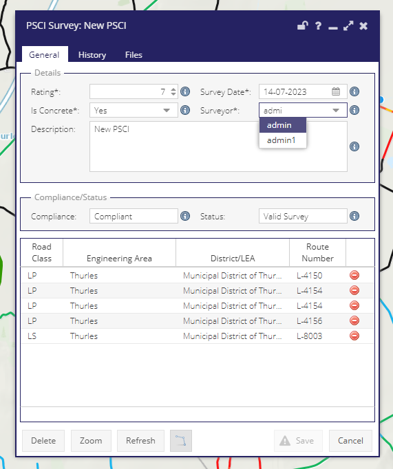
From the General tab, users can:
Set a Rating value from 1 - 10
Set the date of the survey
Set a values for Is Concrete?
Set the Surveyor from a searchable list of system users
Write a description for the survey
Activate the line selection tool
Once selected, view Schedule level data for the selection in a data grid
Once selected, view calculated values for Survey Compliance and Survey Status.
From the History tab, users can see edits made to the survey over time.
Users can upload and access attachments in the Files tab.